

Каталог товаров
-
Компьютерная техника, товары для офиса
-
Телефоны, планшетные компьютеры, магазин Apple
- Накладки, задние крышки и чехлы
- Защитные плёнки для экрана
- Зарядные устройства, разъемы и кабели
- Батареи, аккумуляторы
- Зарядные устройства-аккумуляторы (Power Banks)
- Автомобильные и другие держатели
- Наушники hands-free
- Запасные части для мобильных телефонов
- Другие аксессуары (Штативы для селфи, Фото-линзы и т.д.)
- Принадлежности для смарт часов, браслетов
- Игровые приставки и принадлежности
-
Игровые приставки, TV, аудио, видео
-
Компьютерные компоненты, сетевые продукты
- Процессоры
- Материнские платы
- Видеокарты
- Увидеть больше
- Дисководы
- Звуковые карты
- Карты расширения
- Кабели, провода и адаптеры
- Блоки питания (PSU)
- Cистемы охлаждения
- Принадлежности для воздухоохладителей (Термопаста, Рамки и т.д.)
- Принадлежности водяного охлаждения (Радиаторы, Контроллеры и др.)
- Корпуса
- Аксессуары для корпусов (Светодиодное освещение, наклейки и т.д.)
- Рутеры
- Беспроводные (Wireless) адаптеры
- Беспроводные точки доступа (Access Point)
- Антенны и принадлежности для роутеров
- Усилители сигнала (Range Extender)
- Принт-серверы
- Другие сетевые товары
-
Бытовая техника
- Холодильники
- Морозильные камеры
- Стиральные машины
- Сушильные барабаны
- Вытяжные вентиляторы
- Газовые плиты
-
Для детей, малышей
- Автокресла
- Принадлежности для автокресел
- Cпортивные коляски
- Аксессуары для колясок
- Универсальные коляски
- Рюкзаки-кенгуру
- Комбинезоны
- Ходунки
-
Духи и косметика
- Красота и здоровье
- Спорт и фитнес
-
Товары для туризма
- Палатки
- Спальные мешки
- Надувные матрасы, коврики, подстилки
- Принадлежности для еды и питья
- Товары одноразового пользования
- Газовые горелки, печи и аксессуары
- Рюкзаки для путешествий, другие сумки
- Ножи
- Фонари
- Кемпинговая мебель
- Водонепроницаемые упаковки и чехлы
- Туристические гигиенические принадлежности
- Холодильные ящики и сумки
- Первая помощь
- Средства против насекомых
- Различные туристические аксессуары
-
Товары для домашнего хозяйства
- ЭКО чистящие средства
- Стиральные порошки и другие моющие средства
- Средства для мытья посуды
- Средства для мытья рук
- Дезинфицирующее средство для рук
- Средство для мытья посуды в посудомоечной машине
- Средства для чистки унитаза
- Чистящие средства для ванной комнаты
- Средства для мытья пола
- Чистящие средства для стёкол и окон
-
Сантехника и отопление
- Аксессуары для ванной комнаты
- Смесители
- Мыльницы и дозаторы
- Стаканчики и подставки для зубных щеток
- Ершики для унитаза
- Держатели для туалетной бумаги
- Коврики для ванной комнаты
- Занавески для душа
- Раковины
- Унитазы
- душевой кабины
- Ванны
- Душевые лейки
- Аксессуары для раковины
- Принадлежности для унитазов
- Принадлежности для смесителей
-
Зоотовары
- Сухой собачий корм
- Влажный корм (консервы) для собак
- Лакомства для собак
- Пищевые добавки и витамины для собак
- Поводки и ошейники
- Намордники
- Посуда для кормления
- Сумки, клетки и принадлежности для транспортировки
- Šukos, furminatoriai
- Средства по уходу за собаками
- Игрушки для собак
- Спальники
- Одежда и ботиночки для собак
- Устройства слежения для домашних животных
- Собачий туалет
- Принадлежности для корректировки поведения
- Принадлежности для собак и для котов
- Влажный корм (консервы) для котов
- Сухой кошачий корм
- Лакомства для котов
- Пищевые добавки и витамины для котов
- Песок и наполнители
- Кошачий туалет
- Игрушки для котов
- Кошачьи когтеточки, спальные места и домики
- Аксессуары для кошачьего туалета
- Посуда для кормления
- Расчески, фурминаторы
- Средства по уходу для котов
- Сумки, клетки и принадлежности для транспортировки
- Спальники
- Принадлежности для корректировки поведения
- Принадлежности для собак и для котов
- Мебель
-
Для сада, ремонта и дома
- Фототехника, оптика
- Освещение
-
Инструменты
- Авто-мото товары
- Подарки, товары для праздников
-
Торговая точка
- Электронные товары и принадлежности с поврежденной упаковкой
- Товары для детей и домашних животных с поврежденной упаковкой
- Товары для спорта и отдыха с поврежденной упаковкой
- Товары для дома с поврежденной упаковкой
- Бытовая техника и принадлежности с поврежденной упаковкой
- Все товары с поврежденной упаковкой
-
Обувь, одежда и аксессуары


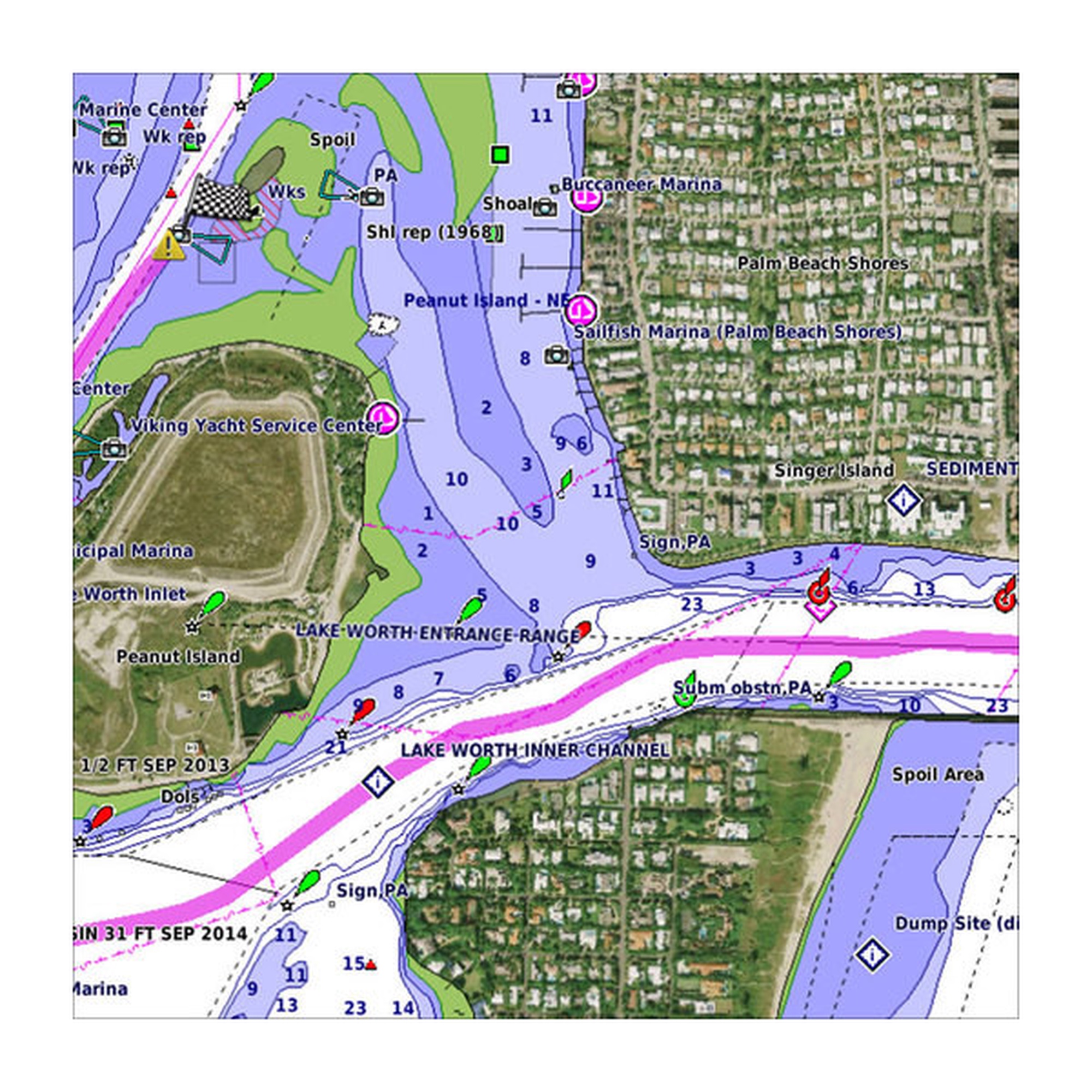



 Our Premium Chart Offering